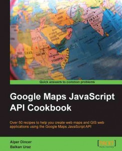
My First Book is available: Google Maps JavaScript API CookBook
I’ve been quite busy for a long time due to projects and I couldn’t find any time to write to blog about what’s going on my life. But this time, instead of writing to blog, I wrote a book on Google Maps JavaScript API v3. Last year, Packt Publishing contact me to write a book on Google Maps JavaScript API. After a few discussion, We (I and with my collegue, Balkan Uraz) decided to write this book. In this book, we didn’t add “V3” to end of API, beacuse “V2” is already deprecated and there is only one valid JavaScript API for now. Anyway, you can buy the book from the following addresses :
Packt Pub | Amazon | Barnes & Noble | Safari Books | O’Reilly
This book is written in a CookBook concept that includes more than 50 recipes. Recipes includes the full code for the subject given with related explanations. Even it is a cookbook, it also includes details about the usage of Google Maps JavaScript API in different conditions. Book includes 8 chapters which are given as follows:
Chapter 1: Google Maps JavaScript API Basics
Chapter 2: Adding Raster Layers
Chapter 3: Adding Vector Layers
Chapter 4: Working with Controls
Chapter 5: Understanding Google Maps JavaScript API Events
Chapter 6: Google Maps JavaScript Libraries
Chapter 7: Working with Services
Chapter 8: Mastering the Google Maps JavaScript API through Advanced Recipes
As it is seen from the chapter list, Google Maps JavaScript API Cookbook is for developers who wish to learn how to do anything from adding a simple embedded map to a website to developing complex GIS applications with the Google Maps JavaScript API. It is targeted at JavaScript developers who know how to get by but who are also seeking the immediacy of recipe-based advice.
If we go over the chapters;
- Chapter 1 is about the basics of Google Maps JavaScript API. You can learn how to create a simple map both on web and mobile platforms, how to change map properties and how to change the base maps.
- Chapter 2 is about adding raster layers to Google Maps JavaScript API. You can add styled maps, tile sources as base maps or overlays, heat maps and other Google’s overlays.
- Chapter 3 is about adding vector layers to Google Maps JavaScript API. You can add markers, lines, polygons, circles, rectangles and popups to maps. Also there is a recipe about animated lines that will spice your maps. There is also recipes about some popular vector formats in GIS like KML, GeoRSS, GeoJSON and WKT.
- Chapter 4 is about working with controls. With the help of this chapter, you can add different controls to your map in order to interact with the user. There are also a recipe to add your own logo the map.
- Chapter 5 is about events in API. Events concept is very important in JavaScript due to its async structure. With the help of events, you can create different types of interactions to power up your geo web applications. For example, you can create two maps with different base maps side by side to compare the difference. Also you can learn how to create your own type of events.
- Chapter 6 is about the JavaScript libraries that enhances the Google Maps JavaScript API. These libraries are both from Google and community to add extra capabilities to API like drawing shapes, area/length calculations, custom popups/info boxes or drag zoom controls.
- Chapter 7 is about working with Google services. With the help of this chapter, you can do geocoding, reverse geocoding, getting elevation, getting directions or showing Street Views on the map.
- Chapter 8 is the most advanced chapter of the book. It is about integration of GIS Servers/Services with Google Maps JavaScript API. In this chapter, you can find recipes on adding WMS layers (both as tiled and untiled), Fusion Tables layers, CartoDB layers, ArcGIS Server Layers. You can also find how to add WMS layers with your own GeoServer instance.
As it is seen from the chapter details, this book can be useful for all developers interested in geo web subjects. Also this can be a useful resource for mobile developers using hybrid development techniques (such as PhoneGap) to add geo features to their mobile apps.
Before writing this book, I thought writing a book is an easy process, but I’ve learn that writing a book is not an easy task especially for developers 🙂 Because most developers like me loves coding and hates the documentation.
My final words are like other authors’ words 🙂 Especially, I want to thank my wife during the write process. I can’t make this without her patience and love. I also want to thank our editors, people helped us at Packt Publishing and reviewers that make our book better.
Hope you can like the book and please let us know if there are any mistakes, problems or suggestions about the book.
